A line of thought within the marine-scientific community holds that the first corals probably originated in Kimbe Bay roughly one-third of the way along the north coast of New Britain island in Papua New Guinea. Diving here leaves little doubt of the area’s diversity because the numbers, as they say, cannot lie.
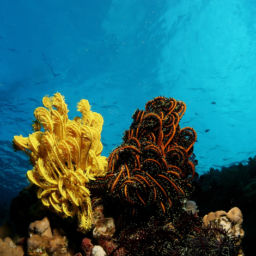
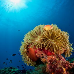
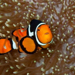
Depending on which scientific survey we look at, Kimbe Bay is home to around 860 species of reef fish, 400 species of coral and at least 10 species of whales and dolphins. To put that in a global perspective — in an area roughly the same size as California, Papua New Guinea hosts almost 5 percent of the world’s marine biodiversity.
Location, Location, Location
New Britain is part of the Bismarck Archipelago, forming the southern ridge of the so-called “Ring of Fire.”
This volatile horseshoe-shaped seismic strip of oceanic trenches and volcanic arcs wreaks periodic havoc around the Pacific Ocean basin. The archipelago’s islands formed between eight and 10 million years ago due to what geologists call “tectonic uplift.”
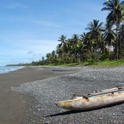
The flight from Port Moresby into Hoskins Airport on the southern edge of Kimbe Bay will put the uplift concept into dramatic perspective. As you cross the narrow Vitiaz Strait from the main island of New Guinea, you’ll catch your first glimpse of New Britain. The western tip of this narrow, crescent-shaped island is roughly 310 miles (500 km) long, 19 miles (30 km) wide at its narrowest point, and 93 miles (150 km) at its widest.
Huge mountain ranges, the result of those tectonic uplifts, run along the island’s spine. These soaring peaks are so high that effectively isolate the north coast from the south and create their own weather patterns. While the north coast follows the normal monsoonal seasons, the south is completely opposite. The mountains also create a partial rain shadow over the north, making the south coast the second wettest place on Earth. Rainfall totals from 20 to 26 feet (6 to 8 m) per year.
As you fly over Willaumez Peninsula, the western boundary of Kimbe Bay, you’ll get a spectacular view of the other visually defining feature of this part of New Britain — volcanoes. Mount Pago and its two smaller siblings rumble periodically.
Beneath Kimbe Bay
The Willaumez Peninsula to the west and Cape Tokoro to the east shelter Kimbe from the worst of New Britain’s weather. A 656-foot (200 m) shelf runs parallel to the shore for about 3 miles (5 km) before dropping down into the abyss. On the northern outskirts of the bay, the seafloor drops off over than 6,500 feet (2,000 m).
Across this deep seascape, dramatic seamounts and coral pinnacles provide shelter for the bay’s marine creatures. The bay’s larger visitors include sperm whales, orcas, spinner dolphins and dugong.
Kimbe Bay’s deep waters and generally benign conditions function as a kind of marine nursery. The area also benefits from the rich currents of the Bismarck Sea. As they flow around the top of the Willaumez Peninsula, eddies direct the nutrient-rich flows into Kimbe Bay.
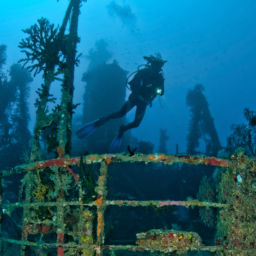
Scuba Diving in Kimbe Bay


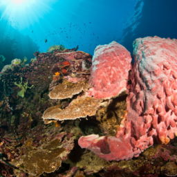
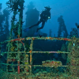
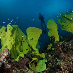
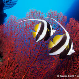
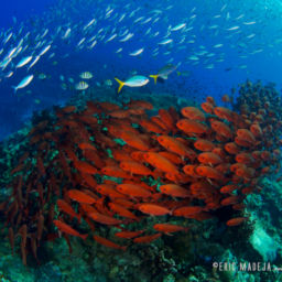
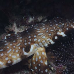
Although scuba diving in Kimbe Bay is on plenty of bucket lists, it’s not a big animal paradise. Rather, the area offers “fish-bowl” diving, as it resembles immersion in a fully stocked aquarium. Visibility often exceeds 130 feet (40 m).
The best places to spot visiting pelagics are seamount dives, such as Bradford Shoals. This isolated outcropping sits on the very edge of the bay. Here, the seafloor is some 4,900 feet (1,500 m) below. Rising from that abyss to within 65 feet (20 m) of the surface, Bradford’s reef structure is mainly flat plates of hard corals, home to colorful small reef fish. Surrounded by deep water and distant from the nearest reef structure, the area regularly draws big fish and pelagics. Divers might see large schools of barracuda, big-eye trevally and dogtooth tuna.
Preserving Kimbe Bay


Agronomists Max and Cecilie Benjamin arrived in New Britain in the late 1960s, interested principally in what came out of the ground around Kimbe Bay rather than what was below its surface. They bought the 800-acre Walindi palm oil plantation in 1969, intending to modernize and improve its operation. But instead, by the early 1970s, they started to scuba dive on the weekends and became the first people to discover the incredible biodiversity of Kimbe Bay.
Walindi Dive Resort opens
The rest is history, and in 1983 the Benjamins opened the now-famous Walindi Plantation Dive Resort. The operation now includes the MV FeBrina liveaboard dive boat.
Although the Benjamins took steps to minimize impact on the reefs, such as installing permanent moorings on all the dive sites, by the early 1990s there were significant changes happening in the Kimbe Bay area.
Until the mid-1980s, the local population lived sustainably as it had for centuries, with virtually no impact on Kimbe Bay’s marine life. But by the end of the decade, New Britain’s developing palm-oil industry was changing that traditional lifestyle. Economic migration into the area resulted in far greater environmental pressure. Issues include rising demand for food, firewood and building materials, as well as a significant increase in pollution.
In 1993, the Benjamins joined the local government and the Nature Conservancy (TNC) to develop an overall long-term conservation strategy for Kimbe Bay. While the bay faced significant environmental challenges, it was largely spared the ravages of cyanide and dynamite fishing. In 1994, TNC, supported by Walindi, conducted the first ever assessment of Kimbe Bay to quantify its biodiversity. The results revealed the true extent of the area’s marine riches. The challenge remains, however, when it comes to how best to preserve it.